
Cyclone Senyar’s Trail and the New Threat Emerging
Cyclone Senyar—described by meteorologists as a “rarest of rare” system due to its unusual formation path from the Strait of Malacca—left widespread devastation across Southeast Asia before moving away from Indian shores. Its landfall on Sumatra triggered deadly floods and landslides that claimed over 103 lives in Indonesia, Thailand, and Malaysia. Even as Senyar dissipated, a fresh threat has rapidly formed: a deep depression over the southwest Bay of Bengal, positioned near south Sri Lanka and the equatorial Indian Ocean.
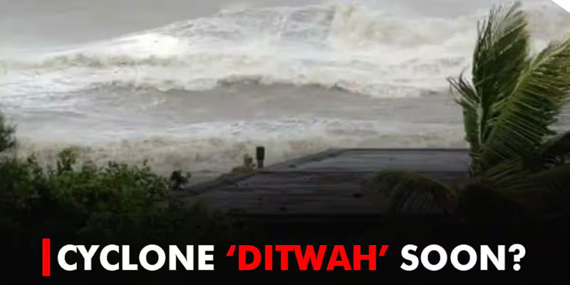
The IMD warns that this system is likely to intensify into the next named cyclone, Cyclone Ditwah, within 24–48 hours. With Chennai and nearby coastal regions on heightened alert, the depression is expected to move north-north-westwards and bring heavy to very heavy rainfall, thunderstorms, and gusty winds touching 60 kmph from November 28–30 across Tamil Nadu, Puducherry, and parts of south Andhra Pradesh.
How Cyclones Get Their Names: Understanding the Nomenclature
Cyclone naming in the North Indian Ocean follows a structured, multinational system overseen by the India Meteorological Department in its capacity as the Regional Specialized Meteorological Centre (RSMC). Since 2004, 13 member nations—including India, Sri Lanka, Pakistan, Bangladesh, Oman, UAE, Myanmar, and others—contribute names from a pre-approved list of 169 options.
“Senyar,” meaning “lion” in Arabic, was submitted by the UAE. If the current deep depression strengthens to sustained wind speeds of 65 km/h, it will be named “Ditwah”—a name further down the same regional naming list. Assigning names helps simplify communication, strengthen public awareness, and maintain clear records during cyclonic emergencies.
Why the Bay of Bengal Produces Frequent Low-Pressure Systems
The rapid emergence of a new cyclonic threat immediately after Senyar reflects a broader climatological trend. The Bay of Bengal generates 5–6 cyclones each year, vastly outpacing the Arabian Sea’s 1–2. Warm sea-surface temperatures, high atmospheric moisture, and monsoon dynamics make the Bay an active breeding ground for low-pressure systems.
These systems most commonly form during the pre-monsoon period (April–June) and the post-monsoon season (October–December)—the peak phase we are currently witnessing. Eastern coastal states bear the brunt of these formations: Odisha and Andhra Pradesh typically see 2–3 cyclones annually, while Tamil Nadu and Puducherry face 1–2. The year 2025 has already experienced Cyclone Montha in October, and now faces back-to-back systems in November.
Meanwhile, IMD tracks 10–15 depressions annually across India, and climate change continues to intensify both frequency and severity. Despite improvements, gaps persist in last-mile early-warning dissemination, especially across rural and densely populated coastal districts.
A Future Defined by Consecutive Cyclonic Events
The transition from Cyclone Senyar to a possible Cyclone Ditwah within days highlights how India’s coastal states are entering an era of sequential and increasingly powerful storms. While forecasting technologies and warnings have improved significantly, the recurring formation of low-pressure systems in the Bay of Bengal poses growing challenges for disaster preparedness, infrastructure, and evacuation planning.
As Chennai and surrounding regions brace for heavy rainfall and potential cyclone impacts, these developments underscore a pressing reality: India must build resilient coastal systems capable of coping with back-to-back climatic shocks. Without such adaptation, each new depression threatens to become another disaster in a rapidly changing climate.
(With agency inputs)